Uploading GPX Files
Once uploaded, SummitGPX processes the route, calculates statistics and creates a public route page that can be shared with runners.
Step 1
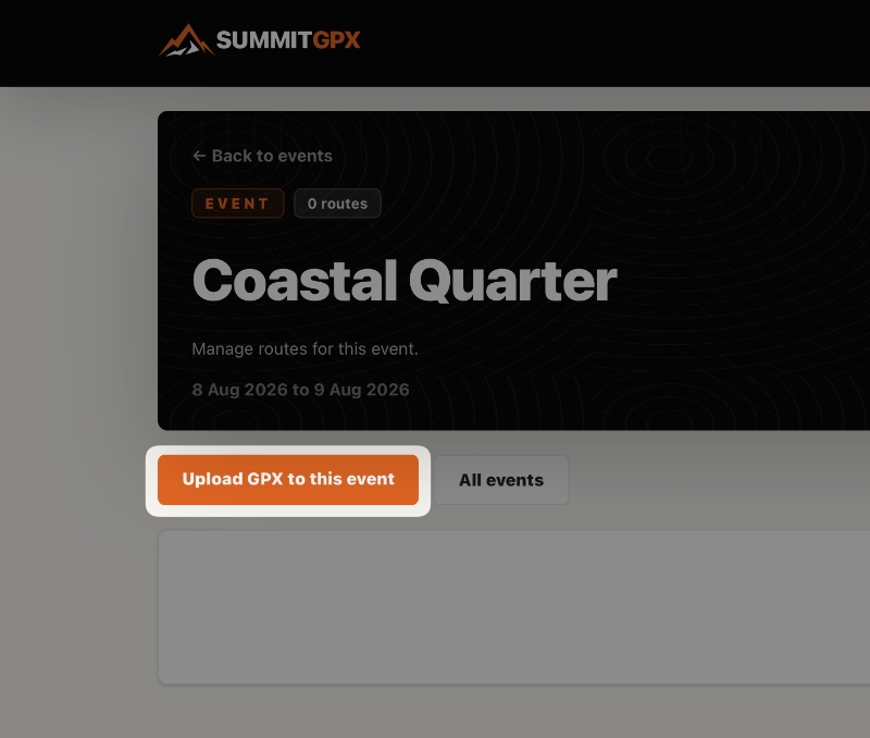
Open your event
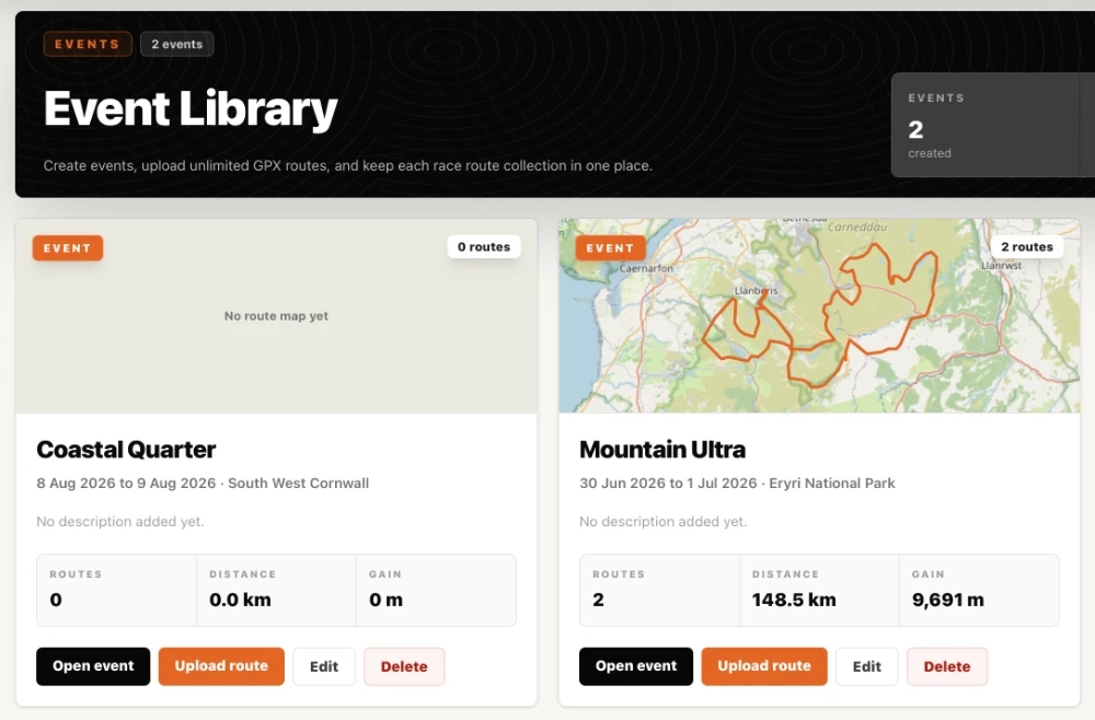
From the Event Library, select the event you want to add a route to.
Step 2
Upload your GPX file
Within your event, click the Upload GPX to this event button and select a GPX file from your computer.
Step 3
Wait for processing
After upload, SummitGPX will process the route automatically.
During processing, SummitGPX may:
- Extract route coordinates
- Calculate distance
- Calculate ascent and descent
- Generate elevation data
- Create an elevation profile
- Generate route statistics
- Create a public route page
Processing time depends on route size and complexity but is usually completed within a few seconds.
Step 4
Review the route
Once processing is complete, review the route page to ensure everything looks correct.
Check:
- Route map
- Distance
- Elevation profile
- Total ascent and descent
- Route name
- Checkpoints (if configured)
Supported File Format
SummitGPX currently supports:
- GPX (.gpx)
For best results, export routes directly from your route planning software or GPS platform.
Elevation Data
SummitGPX can generate elevation information automatically to improve route accuracy and consistency.
Depending on the route configuration, elevation may come from:
- Original GPX elevation data
- SummitGPX generated elevation data
This information is displayed on the route page.
Route Statistics
When a route is processed, SummitGPX automatically calculates:
- Distance
- Total ascent
- Total descent
- Highest point
- Lowest point
These statistics are displayed on the route page and updated whenever a new route version is uploaded.
Common Upload Issues
GPX file will not upload
Check that:
- The file has a .gpx extension
- The file is not corrupted
- The file contains route or track data
Route appears incomplete
Check the GPX file in your route planning software and confirm that the entire route was exported correctly.
Elevation values look incorrect
Try uploading a revised GPX file or review the route using SummitGPX generated elevation data.