 SummitGPX Help Centre
Route features
Map controls and playback
Explore the 2D map, map layers, elevation and route playback.
Public route pages and elevation profiles are included on every plan. Playback is included with Starter and Pro; website embeds and custom branding require Pro.
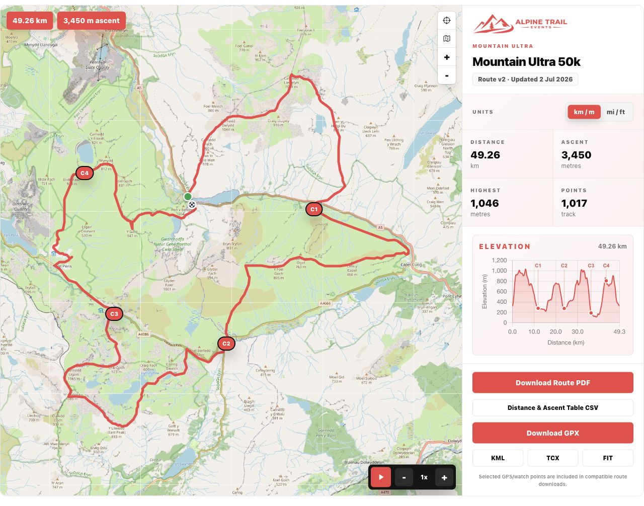
Use the public route map to inspect the course before downloading. Drag to pan, use + and − to zoom, and use the reset/recentre control to bring the full course back into view.
Choose a map layer
The map-layer control cycles through standard, satellite and terrain mapping. Its accessible label describes the next layer. Terrain mapping helps you see landform and paths; satellite imagery helps with ground context. Neither changes the saved course line.
Start, finish and checkpoints
Distinct start and finish markers show direction. On a loop they may be offset on screen so both are visible even when the coordinates overlap. Select course markers to inspect the available checkpoint information. Use the elevation profile to relate a climb to a position on the map.
Play through the course
Where playback is included, choose Play and use the slower/faster controls to change the preview speed. Pause to inspect a section. Playback follows the stored route and is a course preview, not live runner tracking or a finish-time prediction.
Is there a 3D view?
The current route viewer uses a 2D map. Standard, satellite and terrain are map layers; terrain is not a 3D tilt view. There is no verified 3D-view control in the current interface.