 SummitGPX Help Centre
Route features
Downloads and exports
Choose route files, printable PDFs, checkpoint CSVs and split GPX sections.
GPX downloads are included on every plan. Starter adds KML, TCX and checkpoint exports, including PDF and CSV; Pro adds FIT and split GPX downloads.
Download from the public route page or website embed. Each current-route download uses the latest processed course. Runners need to import a new file into their device app and sync it to the watch after a course change.

Choose a format
- GPX: the standard course download on all plans.
- KML: for compatible mapping tools; normally Starter and above.
- TCX: a course file for compatible devices; normally Starter and above.
- FIT: a course file for compatible devices; normally Pro.
Import support and download support are different: accepting a FIT upload does not mean FIT downloads are included in every plan. Choose a format your device supports and inspect the imported course before race day.
Checkpoints on GPS devices
For the main GPX, TCX and FIT downloads, enable route-level checkpoint downloads and select Show on GPS/watch on the individual points. Choose a device point type such as water, food or summit. Map-only points stay off these files. A device may rename or ignore points; SummitGPX cannot guarantee an identical display on every watch.
Printable route PDF and CSV table
The current Download Route PDF creates a landscape route document with a map and elevation profile, followed by a detailed checkpoint distance/ascent table where available. Let the map finish loading before downloading. The CSV provides table data for a spreadsheet. Distance and elevation units follow the page selections; the PDF uses supported organiser branding.
Split a long course
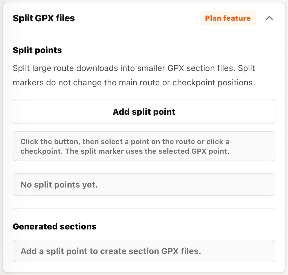
- Open the organiser route and expand Split GPX files.
- Choose Add split point and click the route or a checkpoint marker.
- Review section names, endpoints and distances.
- Download the split GPX ZIP from the public page or embed and inspect the section files.
Split files require split-download access and valid split points that produce at least two sections. Splitting does not change the master course. Section files include start/finish waypoints and eligible selected checkpoints; their rules differ from the main-download master switch. Recheck split points after changing the route version.
Missing or failed downloads
For a missing format, check plan access. For a missing table, check checkpoint/export availability. If PDF generation fails, reload, allow the map and export tools to load, then retry. For watch problems, check the file and device workflow.